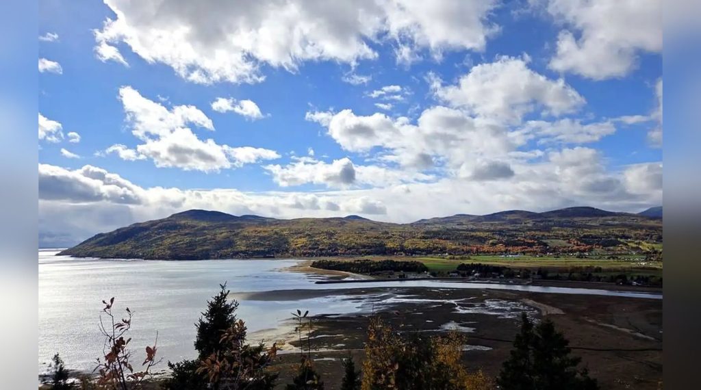
Belvédère Baie-Saint-Paul: The Free Route 138 Viewpoint You Shouldn’t Drive Past
Last updated: November 5, 2026
We pulled over for five minutes on Route 138 — and found four landscapes in a single glance. Real reviews — my own money, my own experience.
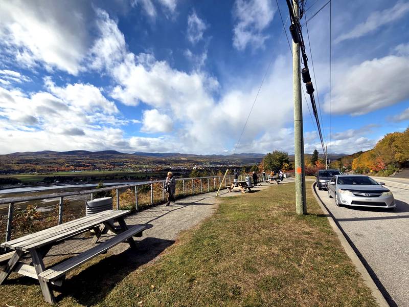
Some of Québec’s best views don’t have a ticket booth — just a shoulder on the highway, a wooden railing, and five minutes to spare. On October 9, in the middle of our Charlevoix fall road trip — after slow, steamy days at the Fairmont Le Manoir Richelieu in La Malbaie — we pulled over at the Belvédère Baie-Saint-Paul, a roadside lookout on Route 138. The sky that day was grey and moody. And honestly? It still looked like this. Standing there in person, it is so much better than any photograph — mine included.
🌿 Quick Take
- A free roadside lookout on the Route 138 corridor — no ticket booth, just a railing, picnic tables, and five minutes to spare.
- One view, four landscapes: the town of Baie-Saint-Paul, the tidal flats, the river, and the Laurentian hills.
- We came on October 9, and the hills were at their peak colour.
- The tide rewrites the view: at low tide you get the sculpted flats and silver channels.
- 📍 Route 362 (Route du fleuve), just off Route 138 above Baie-Saint-Paul.
🚗 A Free Stop Right on Route 138
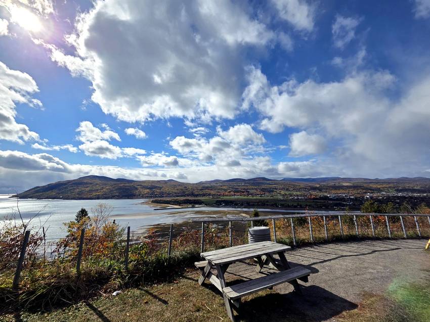
There is nothing complicated here, and that is the charm. The belvedere is a simple roadside rest area: a row of picnic tables strung along a railing, room to park, and the whole valley poured out below you. No tickets, no fee — you just slow down, pull in, and breathe. We were far from the only ones with the idea; on a fall weekend, half the cars on Route 138 seem to pause here for a coffee and the view.
🌊 One View, Four Landscapes
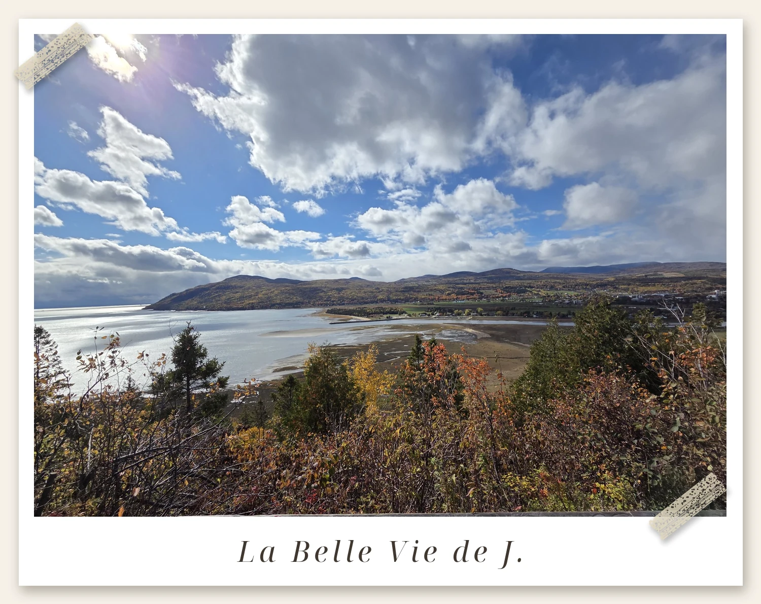
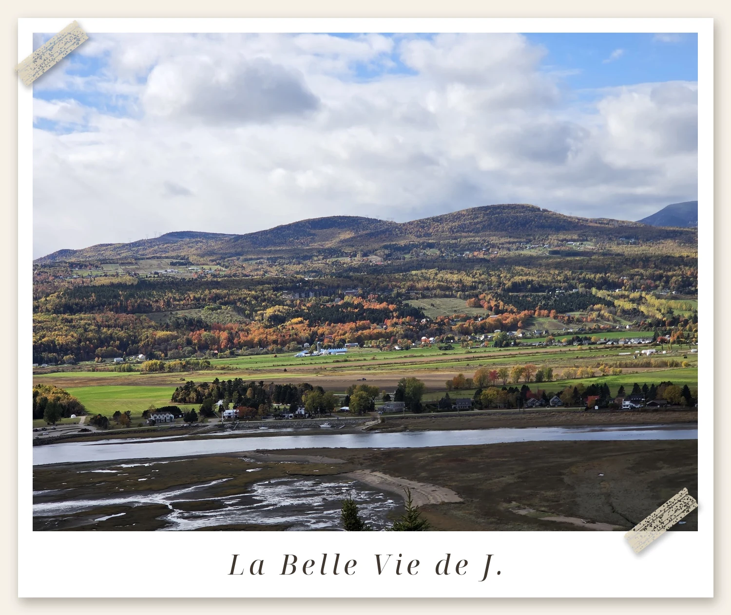
What makes this lookout special is how much fits into a single glance. Below you, the little town of Baie-Saint-Paul spreads along the shore, church spires and all — an artists’ town beloved across Québec. In front of it, the Rivière du Gouffre fans out into wide tidal flats; we arrived at low tide, when the river shrinks to silver threads winding through the mud. Beyond the headland, the St. Lawrence opens wide, and across the water sits Île aux Coudres, the island Charlevoix keeps for itself.
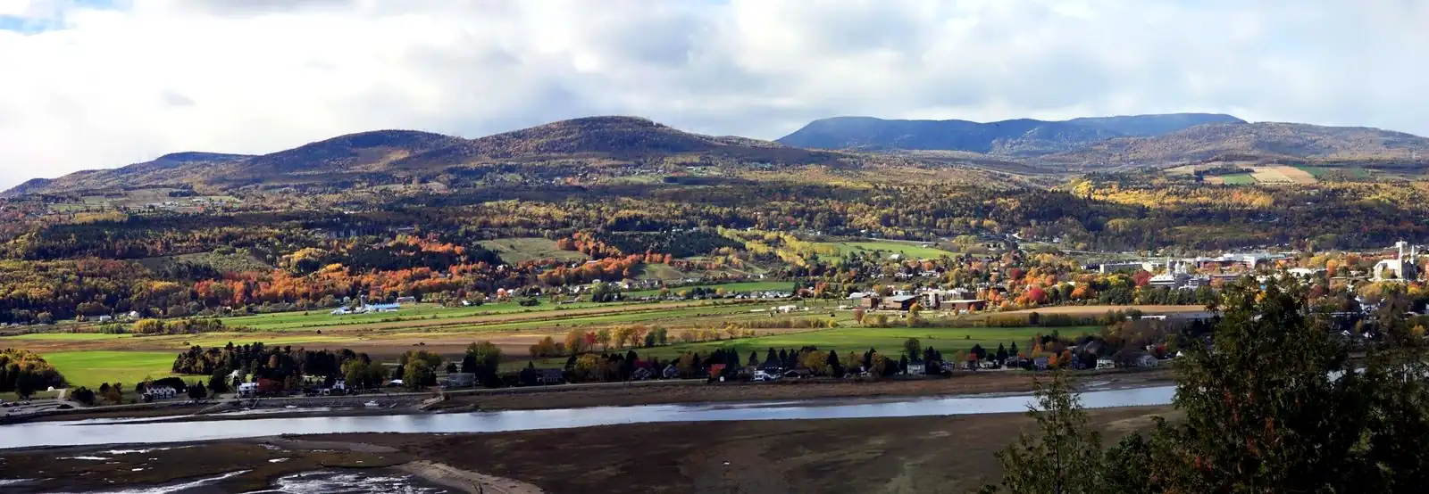
I shot these frames one after another and stitched them into a single panorama — that is genuinely how wide this view is. Town, river, bay and mountains, all in one slow turn of the head.
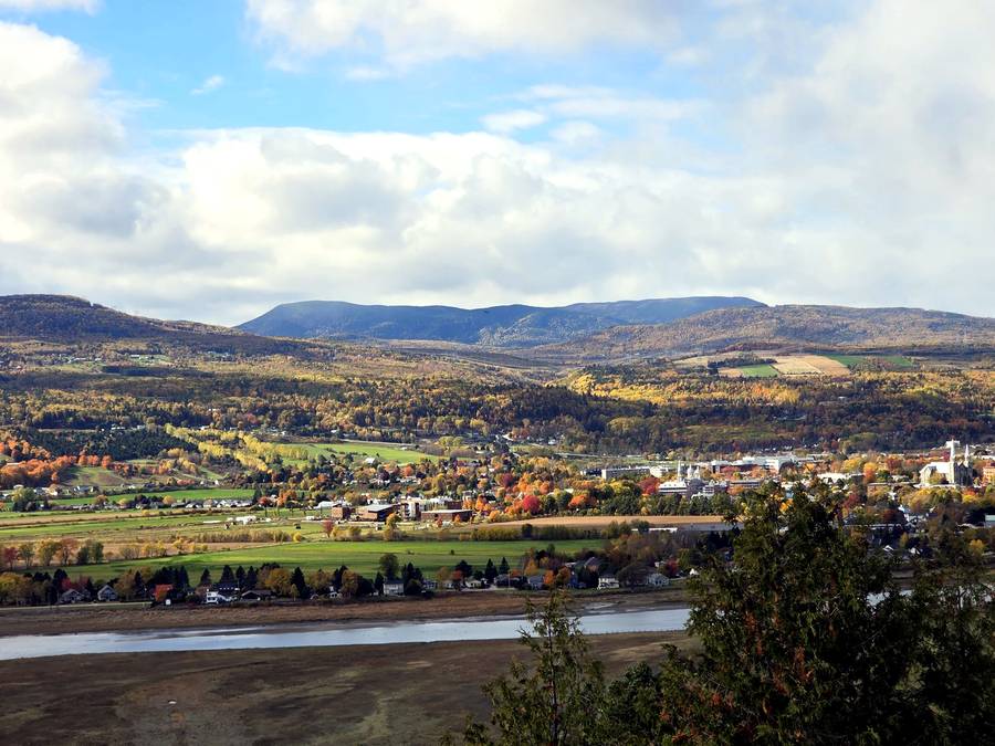
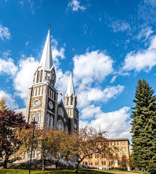
📍 Baie-Saint-Paul downtown — rue Saint-Jean-Baptiste and the twin spires of the Saint-Pierre-et-Saint-Paul church. Photo: bDom / Flickr, CC BY 2.0 (cropped)
🍁 Peak Colour in Mid-October
We came on October 9, and the Laurentian hills were at their peak: layer upon layer of gold, rust and red rolling down to the green fields along the river. Right now, in mid-October 2026, the colour is still at its best — so if you are anywhere near Charlevoix this week, consider this your sign to go. Settle at one of the picnic tables, let the wind do what it wants with your hair, and just look.
💡 Good to Know Before You Stop
📍 Find it: Route 362 (Route du fleuve), just off Route 138 above Baie-Saint-Paul — View Belvédère Baie-Saint-Paul on Google Maps
The tide rewrites the view. At low tide you get the sculpted flats and silver channels; at high tide the whole bay turns into a calm sheet of water. Both are worth seeing, and they never look the same twice.
Don’t let a grey sky talk you out of it. Our day was properly overcast, and I was a little sad about it — until I looked at the photos and realised the colours had carried the day anyway. In real life, with the depth and the wind and the scale of it, it is far more beautiful than this page can show.
It pairs perfectly with a Charlevoix loop. On the same trip we stood at the hilltop cemetery lookout in La Malbaie, visited the oldest wooden chapel in Tadoussac, and stopped at Sainte-Anne-de-Beaupré on the drive home. This little belvedere holds its own in that company.
🎨 Below You, an Artists’ Town
The town spread out beneath the lookout deserves a stop of its own. Baie-Saint-Paul is one of Charlevoix’s cultural capitals: from the early 20th century, painters like Clarence Gagnon came here for exactly this light and these landscapes, and the tradition stuck. Today, rue Saint-Jean-Baptiste is lined with galleries, ateliers and cafés, and the drive down from the belvedere into the town centre is part of the pleasure. The view gives you the landscape; the town gives you the life that goes with it. Together, they are the complete visit.
⛴️ The Island Across the Water — and the Tide That Decides
Île aux Coudres, the island you can see across the water, is a real visit, not just scenery: the Société des traversiers du Québec (STQ) ferry from Saint-Joseph-de-la-Rive is free and takes cars. The loop around the island is about 23 km — perfect by bike or on a slow drive. Schedules change with the season, so check them on the official STQ site. For the belvedere itself, the other timetable worth checking is the tide, on the official Canadian tide tables: arrive at low tide for the silver threads, arrive at high tide for a bay turned into a mirror.
🗓️ And the Rest of the Year?
Fall is the headline season, but the belvedere does not close with the leaves. In spring, the river swells and the flats turn green; in summer, this is the cool stop on a hot driving day, with the island looking close enough to touch; in winter, the landscape goes black and white, the bay freezes in places, and the silence is total. Every season rewrites the same viewpoint. If you pass on Route 138 for another reason — skiing in winter, whales in summer — the five-minute stop is the same, and still worth the turn of the wheel. One itinerary tip: driving down from Québec City, try the return along Route 362, the Route du fleuve, instead of the 138. The belvedere sits between the two roads, and the riverside version turns the drive home into a second outing.
📸 The Panorama, Step by Step
To bring the view home, work the way the belvedere invites you to: slowly. Start at the left — the town and its spires — then let your eye follow the river out to the bay and the island. For photos, three or four slightly overlapping frames stitch together cleanly in any panorama app, and the result finally does the place justice. Morning light comes from behind the hills and lights up the flats; late in the day, it is the town that glows. On a grey day, do not put the camera away: saturated fall colours under an overcast sky often give the richest images, with no harsh shadows.
Finally, plan for the wind: up on the Baie-Saint-Paul heights, it easily feels a few degrees cooler than down by the river. One extra layer in the bag, and your five-minute stop can become a real half-hour pause, coffee in hand, with no eye on the clock.
Some stops you plan for weeks. This one asks for nothing but a turn of the steering wheel — and it might be the view you remember longest.
Have a wonderful day 💛
— J.
⏱️ The Five-Minute Stop, Done Right
- Check the tide first: at low tide you get the sculpted flats and silver channels; at high tide the whole bay turns into a calm sheet of water.
- Pack one extra layer: up on the heights, the wind easily makes it feel a few degrees cooler than down by the river.
- Shoot the panorama in three or four slightly overlapping frames, working left to right — town, river, bay, island.
- Do not let a grey sky talk you out of it: saturated fall colours under an overcast sky often give the richest images, with no harsh shadows.
- Take Route 362, the Route du fleuve, on the way back — the riverside drive home becomes a second outing.
🧮 The Stop, by the Numbers
Five minutes is the number everyone quotes for this stop — but the stop repays a little arithmetic. In that one glance from the railing you get four landscapes at once: the town, the river flats, the bay and the mountains. And the tide doubles the offer. Low tide and high tide are two different viewpoints wearing the same name, so the same five minutes never shows you the same picture twice.
The island across the water runs on numbers too: a free STQ ferry from Saint-Joseph-de-la-Rive, then a loop of about 23 km once you land — an easy hour or two of slow driving or cycling. And there are two roads, not one: Route 138 brings you up, and Route 362, the Route du fleuve, takes you home along the water. Add the one extra layer this post keeps recommending, and the five-minute stop quietly becomes thirty. Cost of entry: zero. Cost per landscape: also zero — divided four ways.
You May Also Like
- La Malbaie’s Hilltop Cemetery: The Best View in Charlevoix
- Fairmont Le Manoir Richelieu Review: The Hotel We Return to Every Year When the Cold Sets In
- Sainte-Anne-de-Beaupré Basilica: The Québec Landmark Everyone Should See Once
*Photos: all taken by J. at Belvédère Baie-Saint-Paul, Quebec — except the downtown church photo, credited in its caption.*
Get the Free Canada Savings Checklist
Join the newsletter — get the free PDF checklist and weekly Canada savings tips in your inbox.
Read Next
Some links in this post are referral or affiliate links. If you sign up or buy through them, I may receive a bonus or commission at no extra cost to you. It helps keep this blog running — thank you!