Québec Fall Foliage Drive: Two Shrines, a Cathedral, Four Lookouts & a Chapel from 1747
Last updated: November 5, 2026
Bonjour! It’s J.
Real reviews — my own money, my own experience.
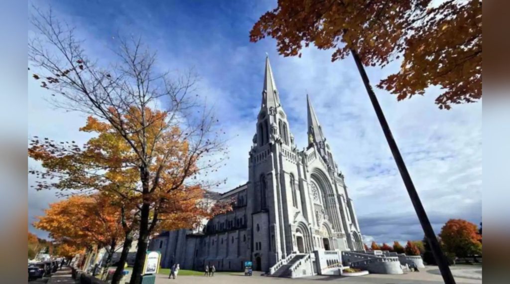
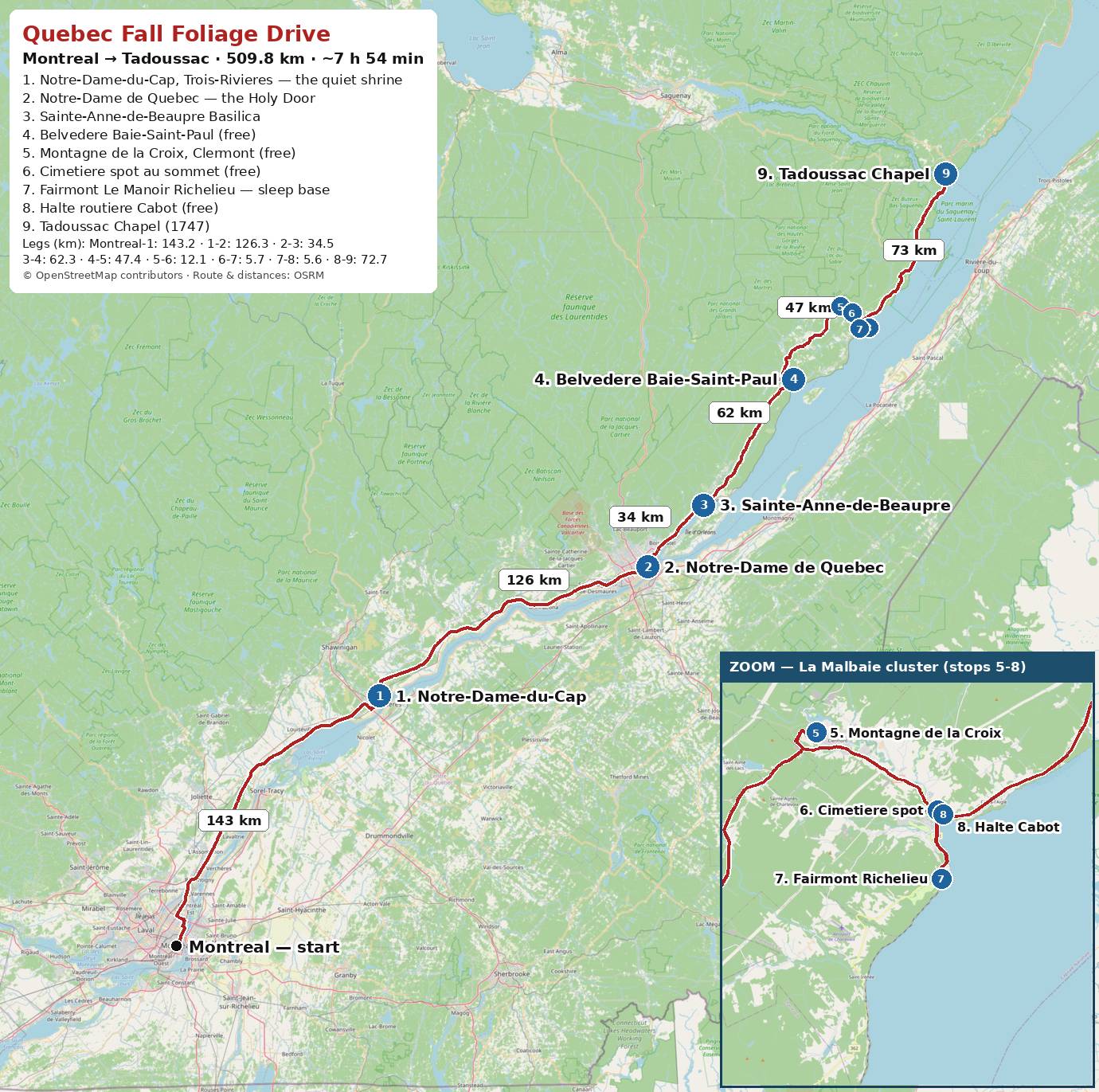
Right now — mid-October 2026 — the Charlevoix hills are at peak colour, and one single drive strings together two beloved shrines, a great cathedral, four free lookouts, a grand hotel on a cliff, and the oldest wooden chapel in Canada. This is that drive: Montréal to Tadoussac, 509.8 km, every stop in order and every distance measured. It is the road trip we just made — and nine years into life in Canada, it is still the one that makes us pull over, again and again, just to look.
Base yourself in La Malbaie for two nights, as we did, and the whole route unspools without rushing: history in the morning, hilltops in the afternoon, and a spa waiting at the end of the day. Here is the map first — then the stops, one by one.
🌿 Quick Take
- One drive — Montréal to Tadoussac, 509.8 km — strings together two shrines, a great cathedral, four free lookouts, a grand hotel on a cliff, and the oldest wooden chapel in Canada.
- Base yourself in La Malbaie for two nights; most stops cluster around it.
- Every stop is listed in order, with measured distances and driving times for each leg.
- Right now — mid-October 2026 — the Charlevoix hills are at peak colour.
🗺️ The Route at a Glance
| Leg | Distance | Driving time |
|---|---|---|
| Montréal → 1. Notre-Dame-du-Cap | 143.2 km | ~1 h 59 min |
| 1 → 2. Notre-Dame de Québec | 126.3 km | ~1 h 42 min |
| 2 → 3. Sainte-Anne-de-Beaupré | 34.5 km | ~32 min |
| 3 → 4. Belvédère Baie-Saint-Paul | 62.3 km | ~55 min |
| 4 → 5. Montagne de la Croix | 47.4 km | ~52 min |
| 5 → 6. Cimetière spot au sommet | 12.1 km | ~23 min |
| 6 → 7. Fairmont Le Manoir Richelieu | 5.7 km | ~9 min |
| 7 → 8. Halte routière Cabot | 5.6 km | ~8 min |
| 8 → 9. Tadoussac Chapel | 72.7 km | ~1 h 14 min |
| Total | 509.8 km | ~7 h 54 min |
How to split it. Day one: Montréal to Trois-Rivières for Notre-Dame-du-Cap, then on to Québec City for Notre-Dame, then east along the river — Montmorency Falls is right on the way — to Sainte-Anne-de-Beaupré and the Baie-Saint-Paul lookout, ending in La Malbaie. Day two, from the La Malbaie base: the two hilltop lookouts, an unhurried hour at the hotel, then Cabot and the run up Route 138 to Tadoussac, where the highway crosses the Saguenay on its little ferry. All four lookouts are free, and every church on the route costs nothing to enter.
And honestly, what stays with me most from this whole drive is simple: from Montréal to Québec City, and all the way up to Tadoussac, the fall colour never let up — it was beautiful the entire way.
🌹 1. Notre-Dame-du-Cap — the Quiet Riverside Shrine
🚗 143.2 km · ~1 h 59 min from Montréal
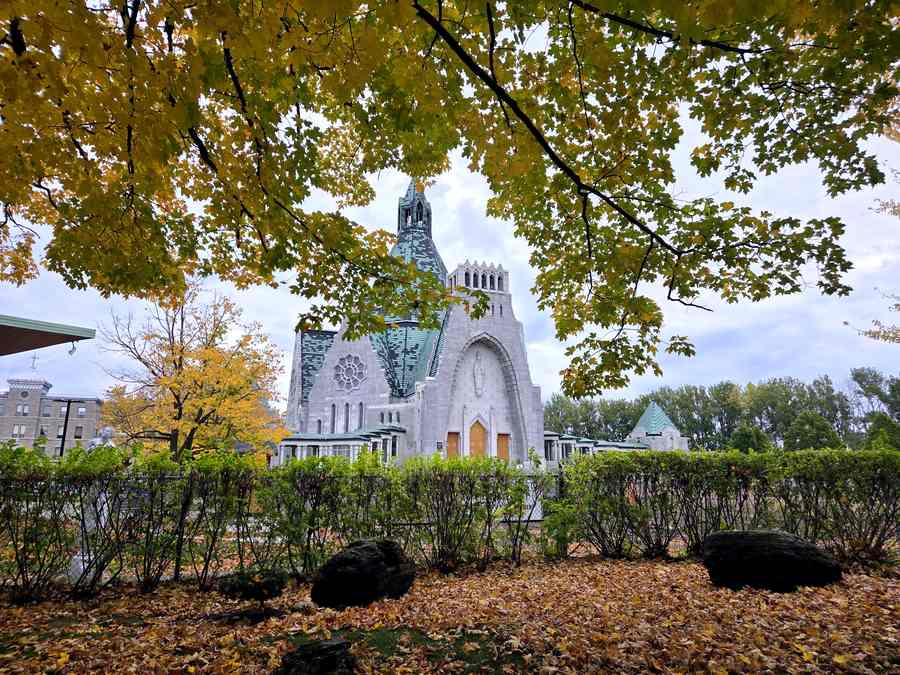
Halfway to Québec City, this is always our first real stop: Canada’s national Marian shrine, right on the St. Lawrence River. The modern basilica glows with a whole wall of blue stained glass, and a few steps away stands the little fieldstone Old Shrine of 1720 — where, in 1888, the statue of Our Lady famously opened her eyes. But honestly, the gardens are the highlight: rosary paths, bronze statues, benches under red maples, and the river sliding past.
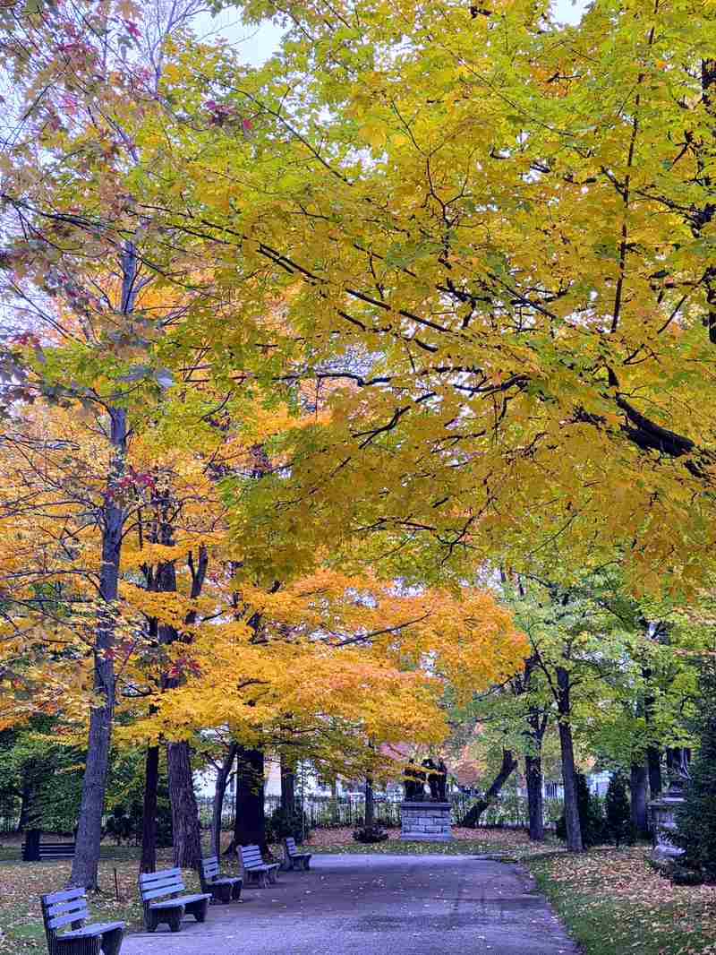
It has quietly become my own little fall ritual — I come back once or twice every autumn, just to walk here slowly. Entry is free, parking is free, and it never feels crowded.
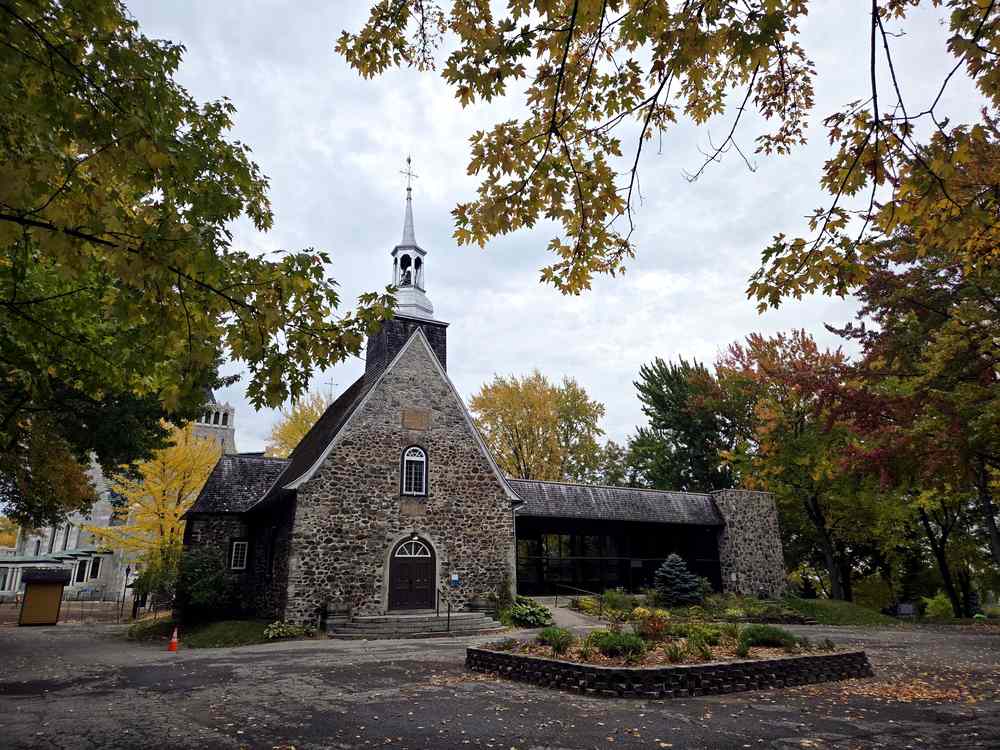
→ Read the full visit: Notre-Dame-du-Cap: The Quiet Riverside Shrine I Visit Every Fall
📍 Sanctuaire Notre-Dame-du-Cap: 626, rue Notre-Dame Est, Trois-Rivières · View on Google Maps
⛪ 2. Notre-Dame de Québec — the Only Holy Door Outside Europe
🚗 126.3 km · ~1 h 42 min from Notre-Dame-du-Cap
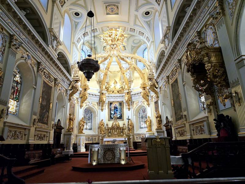
Start where Québec starts: the oldest parish in Canada, in the heart of the old town. Behind its doors hide a soaring golden baldachin, the tomb of Saint François de Laval, and a bronze Holy Door — the seventh in the world, and the only one outside Europe. There is even a small exhibition space where the cathedral’s history is laid out beautifully.
Two practical notes from our visit: the square in front of the cathedral is under construction (October 2026), so you enter around the side — and there is no parking at the cathedral itself, so plan on a paid lot nearby. Entry is free; votive candles are $5.
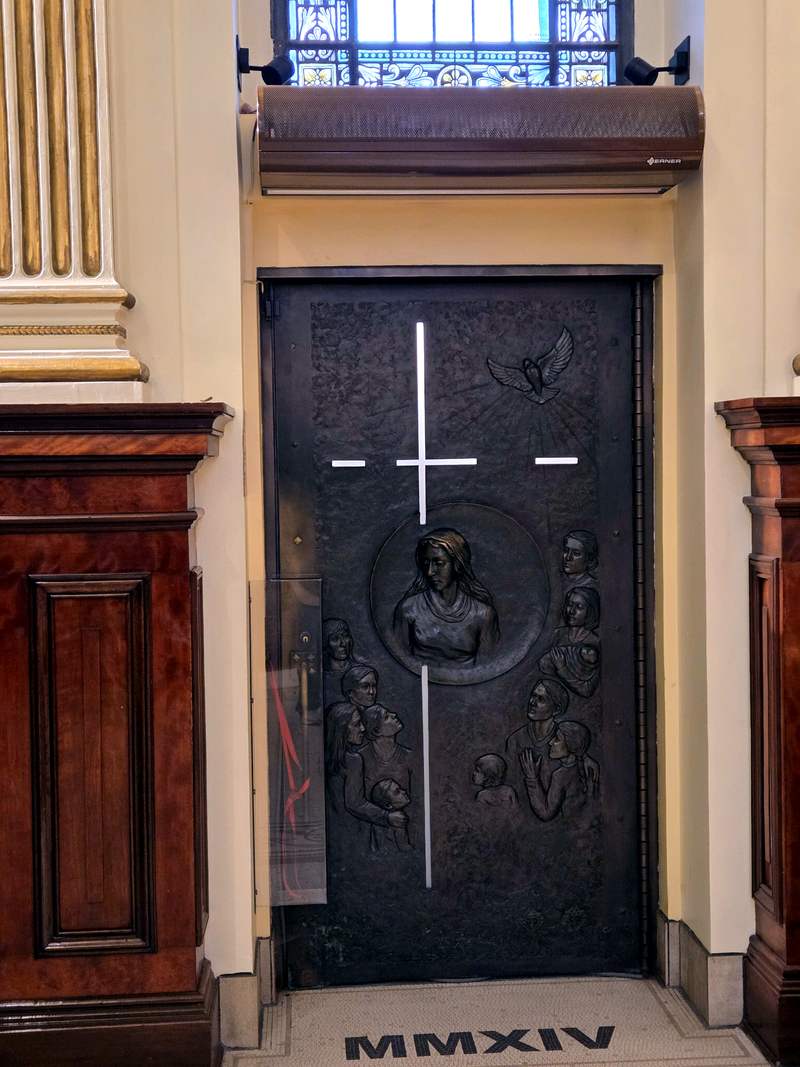
→ Read the full visit: Notre-Dame de Québec Basilica: The Holy Door, the Golden Canopy and Canada’s Oldest Parish
📍 Notre-Dame de Québec Basilica: 16, rue de Buade, Québec City · View on Google Maps
🕯️ 3. Sainte-Anne-de-Beaupré — the Shrine Everyone Should See Once
🚗 34.5 km · ~32 min from Notre-Dame de Québec
Half an hour east, Québec’s most famous shrine rises over the river. Whatever your faith, this is a place to see once in your life: rose windows, candlelit chapels, relics, mosaics — three centuries of devotion layered into one glowing interior. On the way, stop at Montmorency Falls: the 83-metre waterfall is minutes off the same road and pairs perfectly with the basilica.
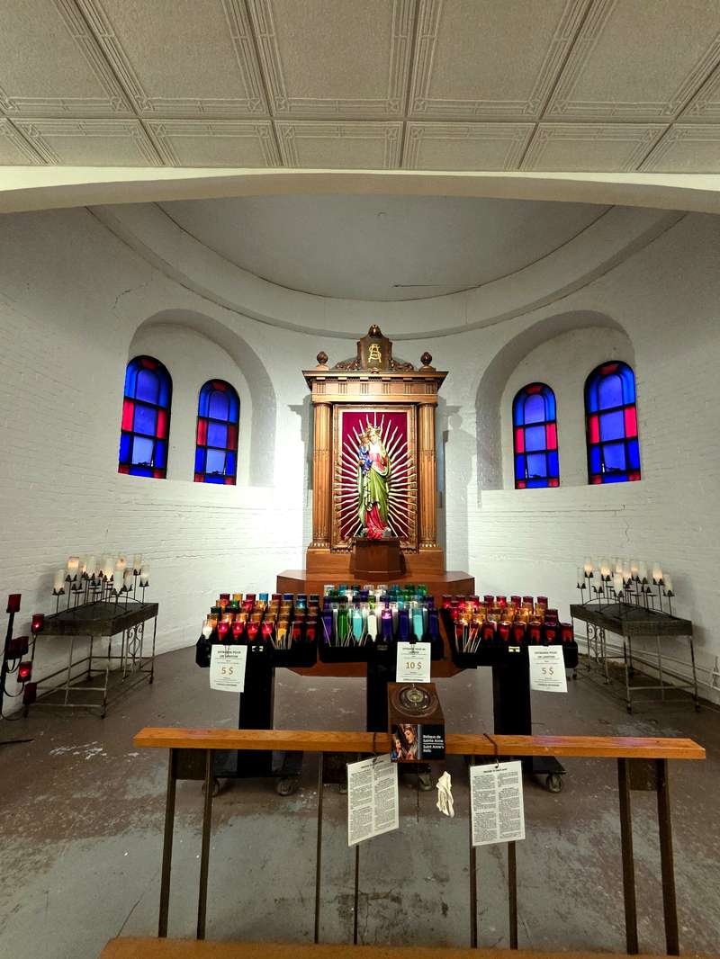
→ Read the full visit: Sainte-Anne-de-Beaupré Basilica: The Québec Landmark Everyone Should See Once
📍 Sainte-Anne-de-Beaupré Basilica: 10018, avenue Royale, Sainte-Anne-de-Beaupré · View on Google Maps
🍁 4. Belvédère Baie-Saint-Paul — Don’t Drive Past This One
🚗 62.3 km · ~55 min from Sainte-Anne-de-Beaupré
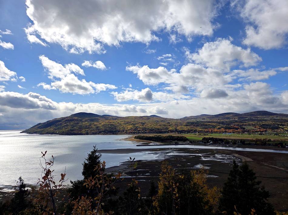
The Charlevoix coast begins here: a free Route 138 pull-off where the whole valley opens at once — the town and its spires below, the tidal flats of the Rivière du Gouffre, Île aux Coudres across the water, and the Laurentian hills burning red and gold behind it all. Our day was grey, and it still looked like this. In real life, it is better. There are picnic tables, so bring coffee.
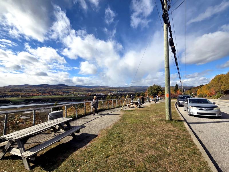
→ Read the full stop: Belvédère Baie-Saint-Paul: The Free Route 138 Viewpoint You Shouldn’t Drive Past · All four lookouts are also gathered in our Charlevoix lookouts guide.
📍 Belvédère Baie-Saint-Paul: Route 362 (Route du fleuve), just off Route 138, Baie-Saint-Paul · View on Google Maps
✝️ 5. Site Patrimonial de la Montagne de la Croix — the Summit Park
🚗 47.4 km · ~52 min from Baie-Saint-Paul
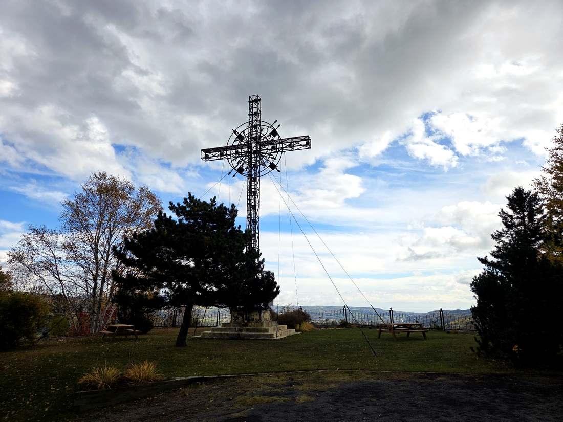
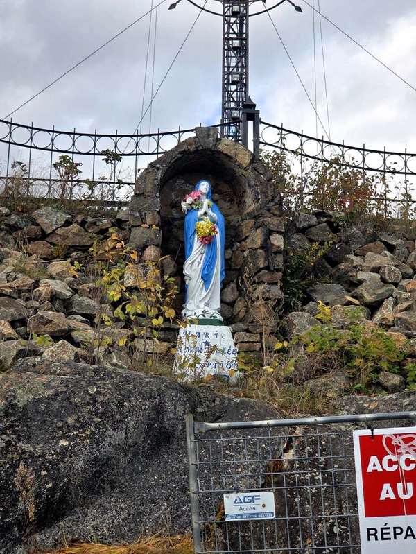
Not to be confused with the cemetery below in La Malbaie — this is a separate stop, a heritage park on its own summit above Clermont. The road up starts unpaved (keep going; it turns to pavement) and ends at a pretty gravel parking lot among the birches. A short path climbs past a stone grotto of Mary to the great cross and a wooden deck floating over the valley. Give it half an hour.
→ Read both La Malbaie hilltop stops in detail: La Malbaie’s Hilltop Cemetery: The Best View in Charlevoix
📍 Montagne de la Croix: Chemin de la Croix, Clermont · View on Google Maps
🌅 6. Cimetière spot au sommet — the Cemetery with the View
🚗 12.1 km · ~23 min from Montagne de la Croix
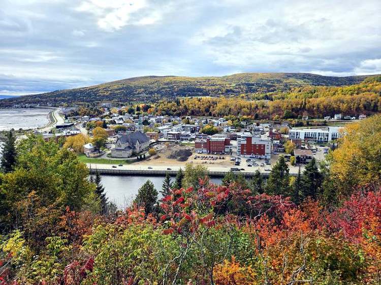
Twelve kilometres away and a world apart in mood: the hilltop cemetery above La Malbaie, where the village, its church and the whole bay spread out below the gravestones, under a giant steel cross. A small confession — the loveliest lookouts so often come with a cemetery attached, here in Québec and back home in Korea too, where ground like this is called myeongdang, the auspicious site families chose for ancestral graves. The ancestors simply had the best eye for a beautiful spot. They picked the good ones first.
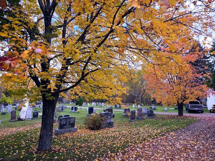
→ Read the full stop: La Malbaie’s Hilltop Cemetery: The Best View in Charlevoix
📍 Cimetière spot au sommet: 89 Rue du Bosquet, La Malbaie · View on Google Maps
🏨 7. Fairmont Le Manoir Richelieu — Sleep Here
🚗 5.7 km · ~9 min from the cemetery
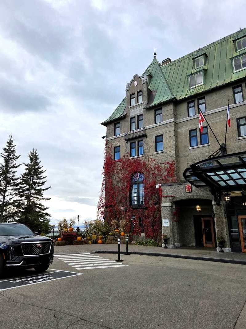
Our base for two nights, and the hotel we return to every year when the cold sets in. The castle-like Manoir sits on the cliff at Pointe-au-Pic, wrapped in red ivy in October. The rooms are fine; the grounds are the glory — a cliffside walking path laid out as a scale model of the solar system — and the outdoor spa, steam rising into the cold air, is the single best way to end a day of hilltops. An underground passage even connects it to the Casino de Charlevoix.
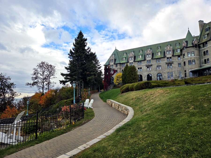
→ Read the full review: Fairmont Le Manoir Richelieu Review: The Hotel We Return to Every Year When the Cold Sets In
📍 Fairmont Le Manoir Richelieu: 181 Rue Richelieu, La Malbaie · View on Google Maps
🧺 8. Halte routière Cabot — Five Minutes, One Seagull
🚗 5.6 km · ~8 min from the Manoir
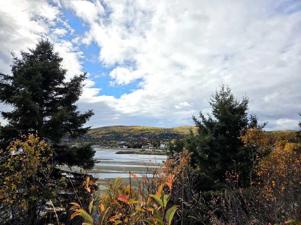
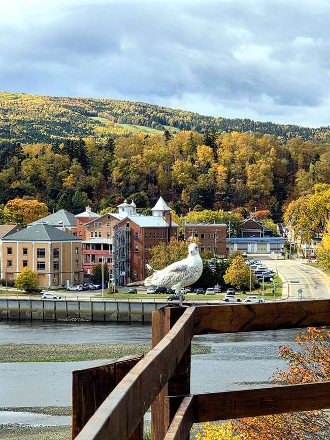
The smallest stop on the route and somehow the one we talk about: a simple roadside rest area on Route 138, barely five minutes from the cemetery lookout, with picnic tables, a wooden fence over the tidal flats — and a seagull who clearly owns the railing. At low tide the bay empties into ribbons of sand and silver water. Stop for ten minutes; you will stay for thirty.
→ See Cabot with the other lookouts: 4 Free Charlevoix Lookouts in One Drive
📍 Halte routière Cabot: Route 138 (Boulevard Malcolm-Fraser), La Malbaie · View on Google Maps
⛪ 9. Tadoussac Chapel — Canada’s Oldest Wooden Chapel
🚗 72.7 km · ~1 h 14 min from Halte Cabot
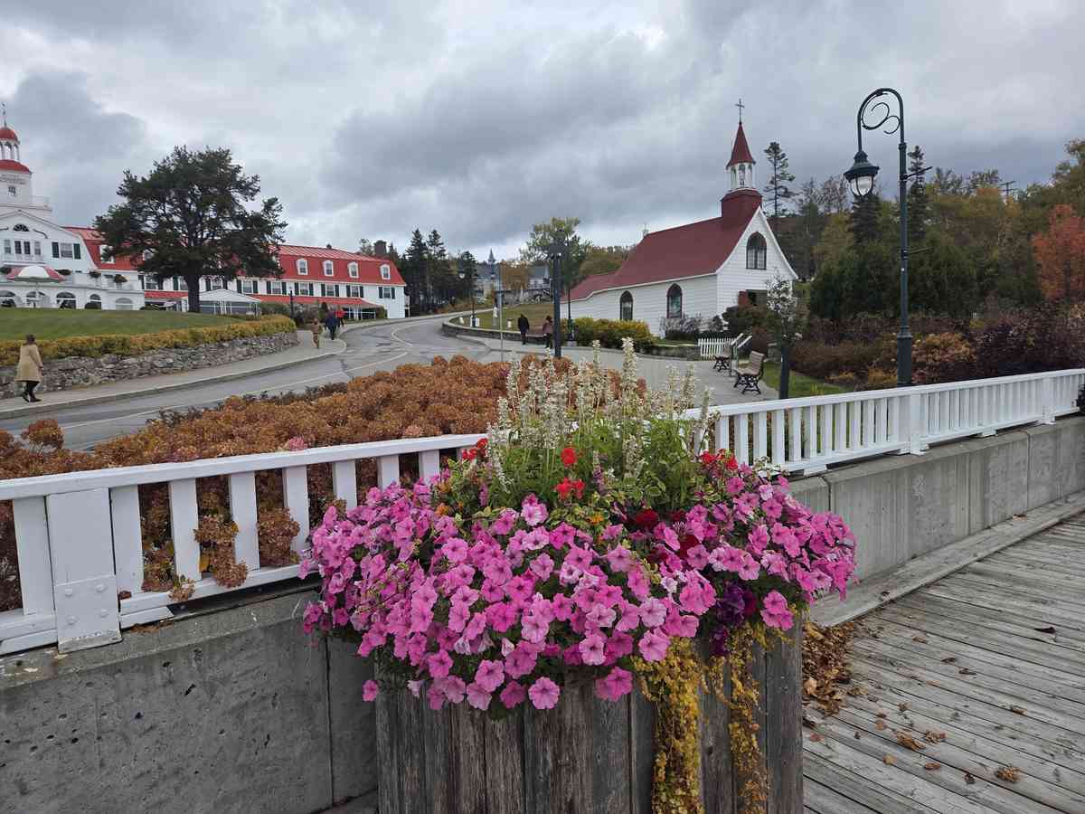
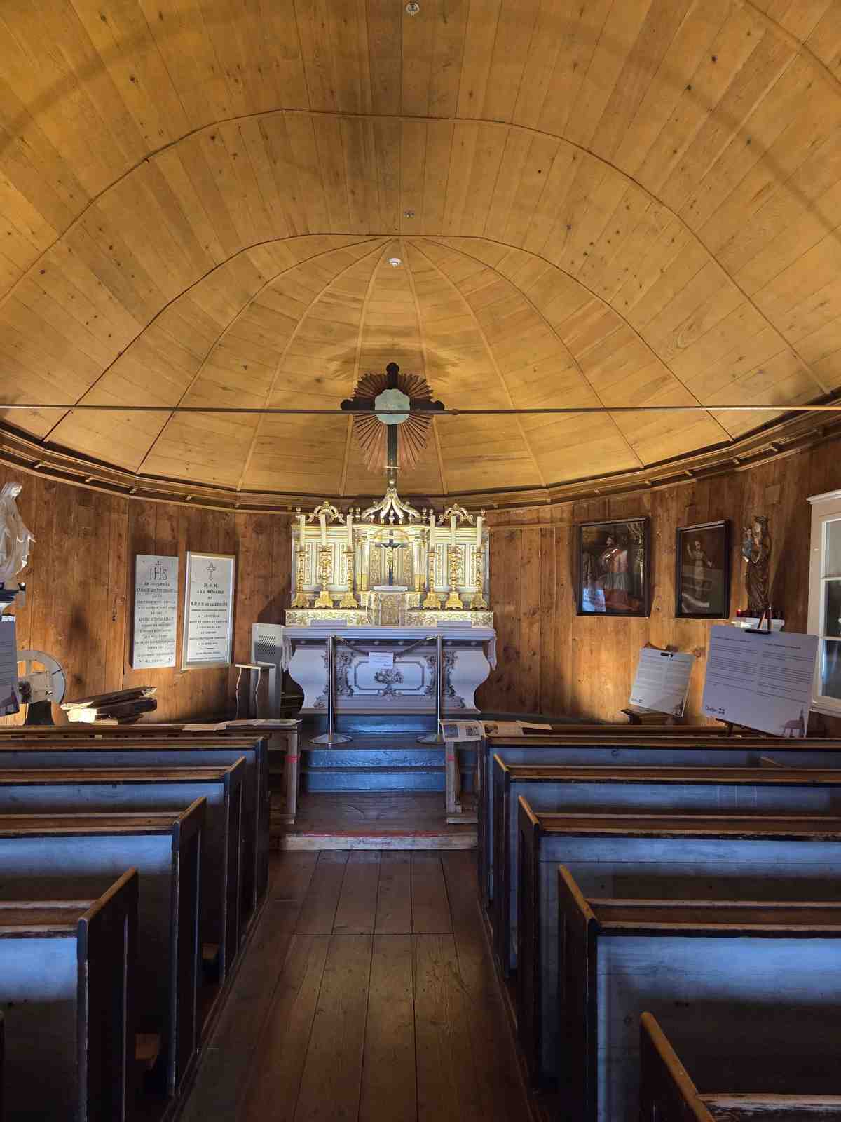
End the drive at the end of the road: a tiny white chapel with a red steeple, standing by the bay since 1747 — the oldest wooden chapel in Canada. Inside, everything is wood and candle-glow: a low beamed ceiling, a gilded altar, and small museum cases holding the chapel’s treasures, down to its 1747 foundation plaque. After the cathedrals and the castles, this little room is the stop that feels like a whisper — the perfect full stop to the route.
→ Read the full visit: Chapelle de Tadoussac: Canada’s Oldest Wooden Chapel
📍 Chapelle de Tadoussac: 169, rue du Bord-de-l’Eau, Tadoussac · View on Google Maps
Two shrines, a cathedral, four lookouts, one grand hotel and a chapel older than Canada itself — 509.8 km, and every kilometre of it beautiful in October. And because we stopped every hour or so — a shrine here, a lookout there — it never felt like a long drive at all. Montréal to Québec City non-stop would honestly be a grind; broken up this way, the distance just melts away. If you drive one fall route in Québec, make it this one.
⛴️ Crossing to Tadoussac: The Free Saguenay Ferry
Driving up Route 138 toward whale country, the road simply ends at the water — and a ferry takes you across. The Tadoussac–Baie-Sainte-Catherine ferry crosses the Saguenay River where it meets the St. Lawrence, and the best part? It’s completely free. Here’s everything I learned riding it in October 2026, with my own photos.
🗺️ 1. Where exactly is it?
The ferry connects two halves of Route 138 split by the Saguenay Fjord. You board at Baie-Sainte-Catherine (119, route 138) on the south side and land in Tadoussac (98, rue du Bateau-Passeur) — or the reverse. There’s no bridge; this ferry is the road.
Tadoussac sits where the fjord meets the St. Lawrence River, in the heart of the Saguenay–St. Lawrence Marine Park. It’s the gateway to whale watching country.
💰 2. Yes, it’s really free
No toll booth, no ticket machine, no app. The Société des traversiers du Québec (STQ) operates this crossing free of charge — cars, motorcycles, bicycles, and pedestrians all ride free. (Source: traversiers.com fares page, as of October 2026.)
This is the part worth emphasizing: a government-run ferry, day and night, and it costs nothing. One less expense to budget for on your Côte-Nord road trip.
🕐 3. Hours and how often it runs
The service runs 24 hours a day, year-round, with no reservations — it’s continuous service, so you just show up and board (Sources: Québec Maritime, Tourisme Charlevoix, as of October 2026).
Crossings run every 20, 40, or 60 minutes depending on the season and time of day. In summer, a third ship joins the fleet and crossings run about every 13 minutes during the day (Sources: STQ official schedule, québecvacances.com, as of October 2026). The crossing itself takes around 10 minutes.
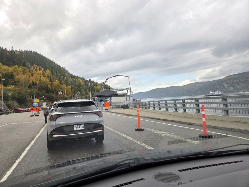
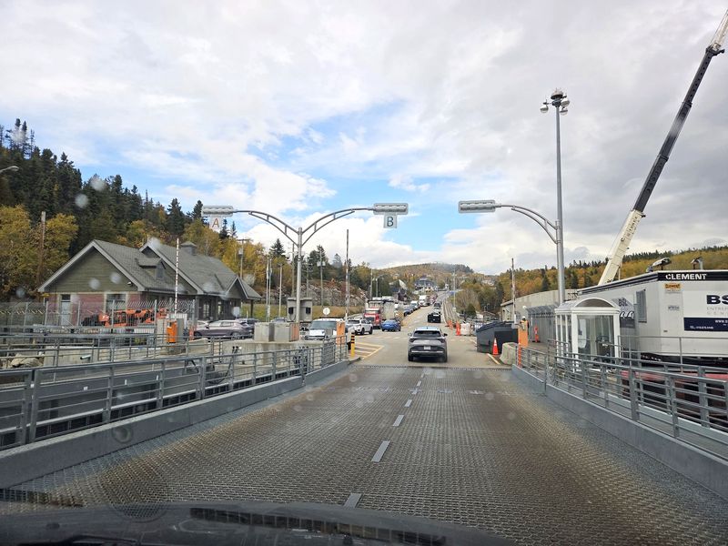
Peak season tip: when the line is long in summer, the timetable still applies but the service is continuous — the ferries keep rotating back and forth, so just join the queue and you’ll be on board soon. That’s exactly what the long line in my photo below turned into: an orderly, moving rotation.
🚗 4. Boarding: what to actually do
Follow the signs to the ferry terminal and join the vehicle line. Staff direct traffic — and in my experience, the ferry staff are genuinely friendly, waving cars into lanes with a smile even on a grey October day.
STQ’s official boarding instructions (as of October 2026):
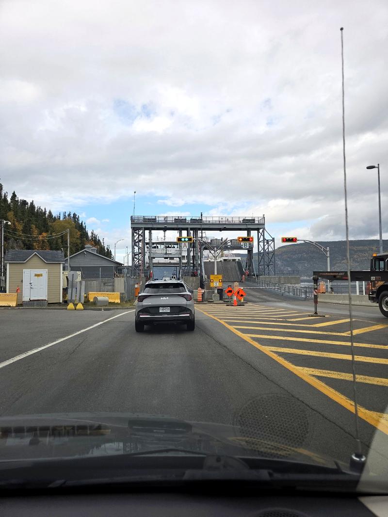
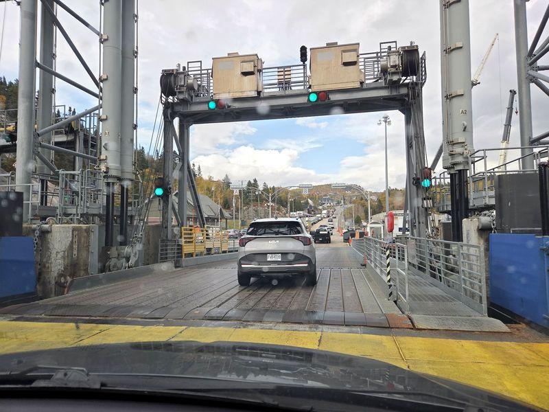
- Wait for the green light or an attendant’s signal before driving on
- Drive slowly onto the ferry and park where directed
- Apply the parking brake, turn off your engine, and lock your doors
- Don’t leave belongings in plain sight
- When offloading, wait as long as possible before starting your engine and wait for instructions before driving onto the ramp
📸 5. The 10-minute crossing
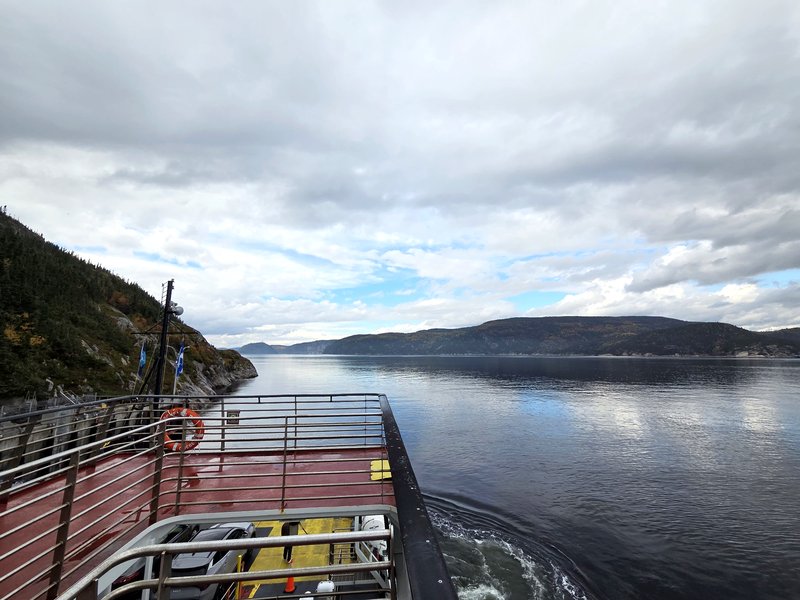
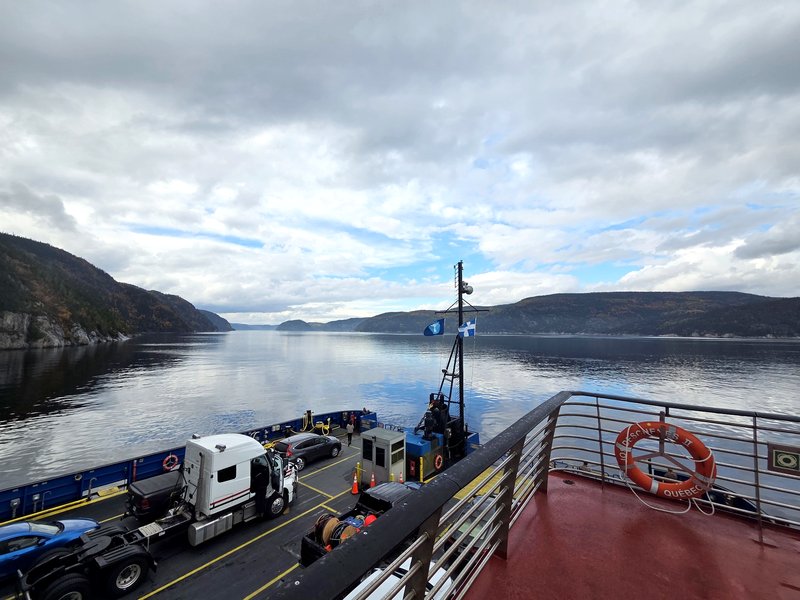
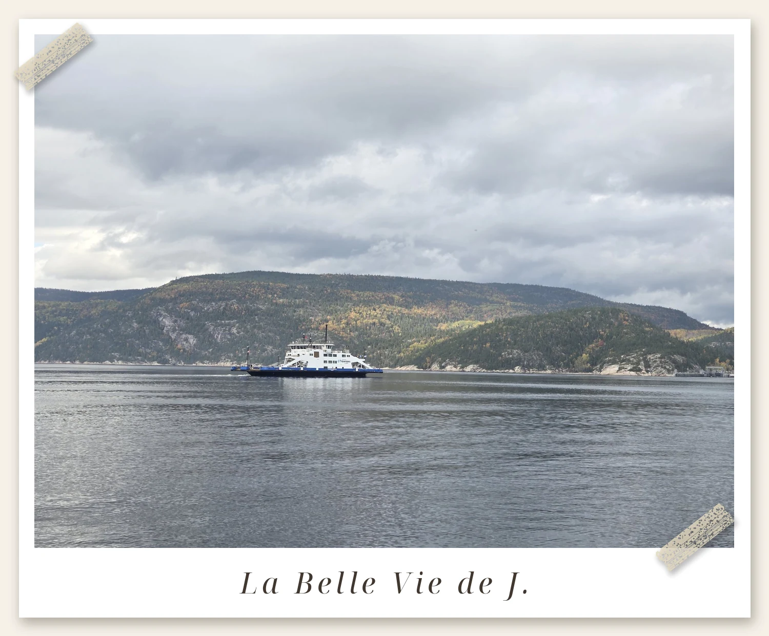
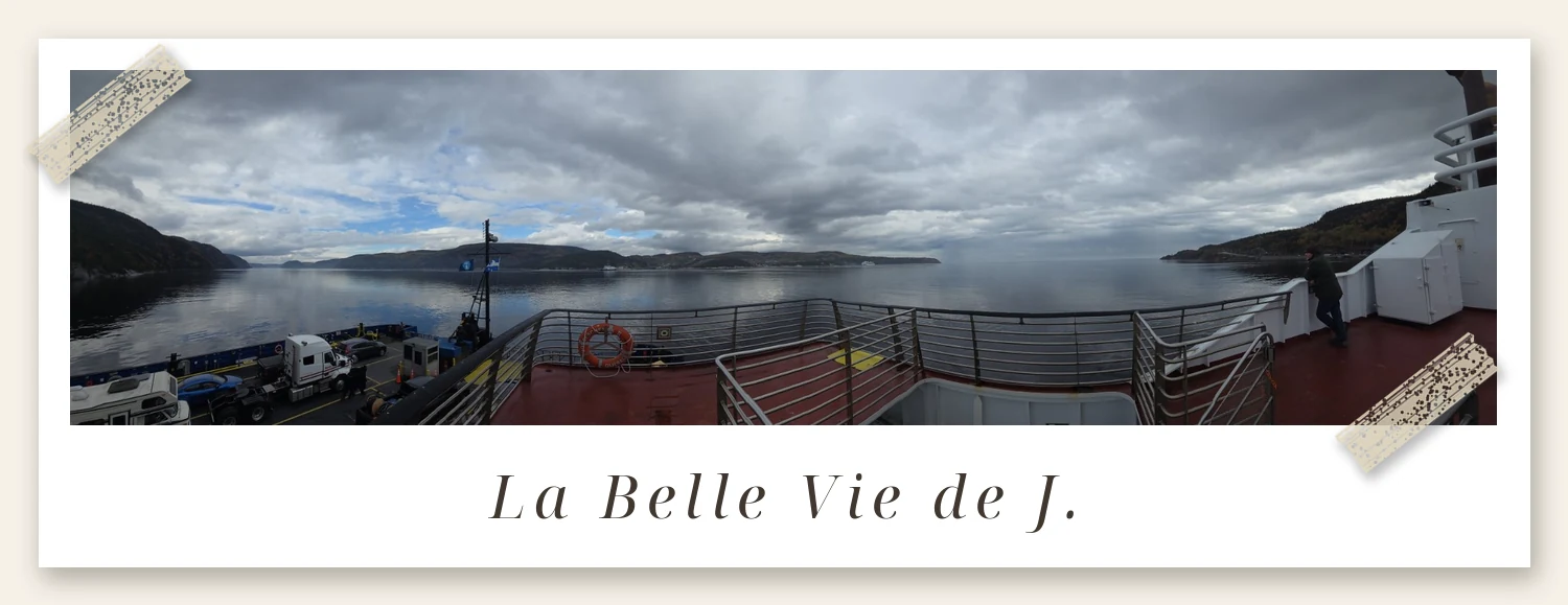
Once aboard, get out of the car if you like. There’s an outdoor deck, an indoor lounge, restrooms, and vending machines. The 1.6 km crossing takes about 10 minutes — just enough time to stretch your legs and breathe the sea air.
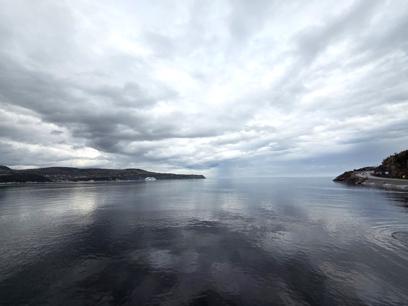
The views are the real reward: the fjord walls on one side, Tadoussac Bay — listed among the most beautiful bays in the world — on the other. Keep your eyes peeled; whales swim these waters.
🌅 6. Arriving in Tadoussac
Disembarking is as simple as boarding in reverse: wait for the signal, drive off the ramp, and you’re on Route 138 again — this time in Tadoussac, minutes from whale-watching departures and the village center.
❓ 7. Quick practical notes
Pets: allowed on leash. Cyclists: walk your bike on the ramps. Snowmobilers: fit wheels to the front of your machine. Disabled passengers: notify attendants on arrival if you need help reaching the passenger deck. (Source: STQ practical information, as of October 2026.)
No reservation needed — ever. Just arrive and queue.
🐋 What waits across the water: Tadoussac’s whales
What makes this ferry special is that where you step off is itself a world-class whale-watching place. The waters off Tadoussac are the heart of the Saguenay–St. Lawrence Marine Park, and the deep channels where krill gather draw minke whales, humpback whales, and even blue whales here to feed in summer. The beluga population that lives in this region year-round is a symbol of the St. Lawrence. The watching season runs roughly from May to October — and if you are lucky, you can spot a dorsal fin right from the ferry deck, so during those 10 minutes of crossing, watch the sea rather than your phone.
Whale-watching tours leave from both Tadoussac and Baie-Sainte-Catherine. If you plan to take a boat tour, it helps to plan your route together with the ferry timing — in peak season, a ferry wait combined with a tour reservation can make the schedule tight. Official Marine Park information and watching rules are available on Parks Canada’s Saguenay–St. Lawrence Marine Park page. The distance rules for whales are set by law, so take particular care when approaching by kayak or private boat.
🧳 Tips for shortening the wait
Finally, a few practical tips. First, on peak-season weekends, crossing early in the morning is when the line is shortest. Second, the crossing itself takes 10 minutes, but the wait is separate — keeping snacks and water in the car turns the wait into a picnic. Third, if you drive this stretch in winter, the service continues, but strong winds or ice conditions can stretch the intervals, so check the STQ notices before you leave. This ferry is not a tourist product; it is the real road for Côte-Nord residents — that is why it is free, and that is why it runs all night. For a traveller, that fact itself is a window into life in this region.
🕐 Ferry Schedule
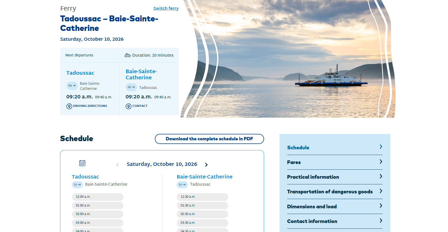
👆 Click the image above to see the live schedule
🔗 https://www.traversiers.com/en/our-ferries/tadoussac-baie-sainte-catherine-ferry/schedule
📞 1-877-787-7483
Have a wonderful day 💛
— J.
If you prefer reading in Korean, I’ve also published the full Korean edition of this review: 타두삭 무료 페리 완전 가이드 | 사게네 피오르 건너 고래 마을 가는 법 (2026).
If you prefer reading in French, I’ve also published the full French edition of this review: Ferry gratuit de Tadoussac : le guide complet pour traverser le fjord du Saguenay.
You May Also Like
4 Free Charlevoix Lookouts in One Drive: Baie-Saint-Paul, Clermont, La Malbaie & Cabot
Fairmont Le Manoir Richelieu Review: The Hotel We Return to Every Year When the Cold Sets In
Sainte-Anne-de-Beaupré Basilica: The Québec Landmark Everyone Should See Once
Photos: all taken by J. in Québec. Map: © OpenStreetMap contributors; route and distances via OSRM.
Get the Free Canada Savings Checklist
Join the newsletter — get the free PDF checklist and weekly Canada savings tips in your inbox.
Read Next

Some links in this post are referral or affiliate links. If you sign up or buy through them, I may receive a bonus or commission at no extra cost to you. It helps keep this blog running — thank you!